
Desktop review
Before we arrive, we look at what is known about the local geology and existing boreholes in the area.
Drilling and Investigation
Groundwater cannot be seen from the surface. A geophysical survey lets our geoscience team read the layers beneath your land, identify promising water-bearing zones and recommend the best point to drill.
One accountable team from the first call to the day the water flows, and after.
Before we arrive, we look at what is known about the local geology and existing boreholes in the area.
Our team takes resistivity readings across your site to build a picture of the layers below.
Our geoscientists interpret the readings to estimate where the water-bearing zones are and at what depth.
You receive a report with the recommended drilling point, the expected depth range and our reasoning.
Our surveys are led by geoscientists and checked against what we actually find when we drill. More than 1,986 boreholes have given us a large record of how survey readings compare with the ground beneath them, and that experience goes into every recommendation we make.
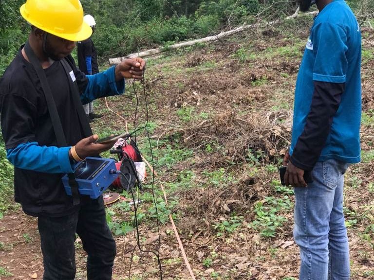
It is a set of measurements of the ground's physical properties. Our geoscientists interpret the results to estimate the layers beneath your site and where water is most likely to be found.
Vertical electrical sounding (VES) measures how strongly the ground resists an electric current at increasing depths. Water-bearing layers respond differently from dry rock and clay, which helps us estimate where water is likely to be and how deep.
No survey can guarantee water. It reduces the risk of drilling in the wrong place and helps us recommend the best point and the expected depth range.
A neighbour's success is a good sign, but ground conditions can change between plots. A survey on your own land is still the safest way to choose your drilling point.
A straightforward report that recommends where to drill, what depth range to expect and why.
A single residential site is usually covered in a short field visit. Larger farms and estates take longer, and we will tell you what to expect when we book it.
Yes. The report is yours. It records the recommended point, the expected depth range and the reasoning behind them.
Most projects combine more than one service. We can deliver them together, so you deal with one team.
Boreholes for homes, farms and industry, sited by survey and drilled properly the first time.
Learn moreSite water surveys, soil assessment and in-house water quality testing before you build, farm or drill.
Learn moreCasing and screens chosen for your ground, so the borehole stays open, clean and productive.
Learn moreTalk to our team about surveys, drilling, pumps or a complete water system. We will give you honest advice and a clear quote.